If you ever played King of the Hill as a child, you already understand the frontier: whoever stood on top controlled the hill—until someone stronger knocked them off. That childhood game echoes the brutal simplicity of early American landholding, where paper charters gave way to possession, and possession often came by force.
By the early 1770s, Britain controlled nearly everything in the North American colonies—except the land itself. It determined which ships entered colonial ports, what goods were taxed, and what laws colonial assemblies could enact. Customs officers guarded every harbor; royal governors signed or vetoed every bill. But west of the Appalachians, where the Ohio Country began, imperial control dissolved. The empire that could regulate a barrel of molasses in Boston could not police a single cabin on the Monongahela.
Parchment Empire
King George III’s Royal Proclamation of 1763 barred colonists from purchasing land directly from Native peoples. All land, according to the Crown, belonged to the King, and only royal authority could grant ownership. Yet, as seen in the recent post on George Croghan and the Walpole Company’s dream of Vandalia, royal rules always looked better on parchment than in practice.
Britain’s strength was maritime, not territorial, a naval and mercantile empire whose reach stopped at the tidewater. Its bureaucracy could govern the coast but never the continent. William Johnson’s Indian Department was thinly manned. After 1763, the British Army in North America was both overstretched and underfunded—yet still far too large in the eyes of colonists who resented a standing army living among them in peacetime. To London, the regiments were necessary to police the frontier and protect imperial claims; to colonists, their presence felt less like defense and more like occupation. The Proclamation Line existed only on maps. Settlers crossed it daily, staking claims London could neither prevent nor punish. Frontiersmen like Daniel Boone, the McAfee brothers, and countless squatters in the Monongahela and Kentucky valleys ignored the King’s decree, cutting paths and cabins through lands “reserved” by law. Every attempt to contain expansion through diplomacy or decree only pushed the frontier further beyond reach.
In practice, Britain ruled by paper—through charters, proclamations, and ledgers—while men like George Croghan and George Washington tried to rule by presence. Each sought to impose their own version of order where the Crown’s had failed. But the truth was that neither controlled anything beyond what they could physically hold. Authority on the frontier wasn’t decreed—it was improvised, defended, and lost again. The contradiction was fatal: an empire that could dictate who traded and what was printed could not control who owned the ground beneath their subjects’ feet.
If the colonists had been willing to pay the taxes needed to fund the ten thousand troops required to enforce the Proclamation Line, the story might have been different. Parliament expected Americans to underwrite their own restraint—first through the Stamp Act, then through import duties. But the British were, in effect, asking the colonists to pay for the figurative wall that kept them in when what they wanted most was to get out. It was a sticking point that the King of England would hear about.
“He has endeavoured to prevent the population of these States; for that purpose, obstructing the Laws for Naturalization of Foreigners; refusing to pass others to encourage their migrations hither, and raising the conditions of new Appropriations of Lands.”
—Declaration of Independence, July 4, 1776 [1]
Contested Boundaries
Britain’s authority ended where the Atlantic faded from view, but the colonies did not step into that vacuum as a single people. Each colony carried its own western vision, rooted in its charter and its own sense of entitlement. Land companies stretched those claims further still, layering speculative paper empires atop boundaries that already overlapped. What emerged was not a coherent frontier but a legal battlefield—surveyors, settlers, and soldiers all staking competing visions of who ruled the West.
At the heart of this disorder were the colonies’ original charters—vague, contradictory, and drafted long before anyone understood the geography of the interior. Virginia, Pennsylvania, and Maryland all pushed toward the Ohio. Connecticut claimed lands hundreds of miles beyond its borders. New England investors dreamed up western provinces that existed only on maps. Because the empire failed to draw clear jurisdictional lines, the colonies drew their own—often with muskets, surveyor’s chains, and royal commissions that no neighbor recognized.
London had no interest in its colonies uniting, and the one major attempt to do so—the Albany Plan of Union in 1754—fell apart before it ever reached the ground. Some colonies were never invited; others, like Virginia, refused to attend. Even among participants, none were willing to surrender taxation or militia control to a central council. What was meant to unite them against France instead revealed how deeply divided they already were.
The Seven Years’ War made those divisions unmistakable. Pennsylvania was reluctant even to defend its own frontier, let alone assist another colony. Its Quaker-led Assembly resisted compulsory military service; political fractures between urban leaders and frontier settlers made militia laws difficult to pass and harder to enforce. For most of its colonial history, Pennsylvania relied on volunteer companies raised privately—an improvisational defense that exasperated its neighbors.
To the south, Virginians earned the name “Long Knives,” a nod to the blades carried by their militiamen and their willingness to use them. Unlike Pennsylvania, Virginia had no hesitation in calling up its militia. Armed defense was seen as both a necessity and a right, and military action an extension of political will. Cooperation with the Carolinas sometimes occurred, but it grew from shared interest, not any sense of intercolonial obligation.
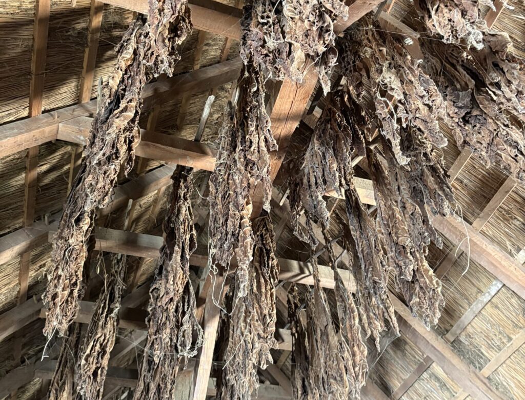
These differences were not just cultural—they were economic. Tobacco dominated both Virginia and Maryland, exhausting the soil rapidly and forcing planters to expand as old fields wore out. Tobacco wasn’t merely a livelihood; it was currency—legal tender up to the Revolution. In many ways the two colonies were mirror images across the Potomac, agrarian and tobacco-bound. The difference was scale: Virginia was larger, more ambitious, and far more aggressive in its push westward.
By this point in our series, we’ve seen how the colonial economy ran on what could be wrested from the earth or earned in exchange for it: animal pelts, tobacco, and foreign coin—mostly Spanish silver and Portuguese gold. For the colonies, wealth was not abstract but physical—mined, trapped, planted, or harvested
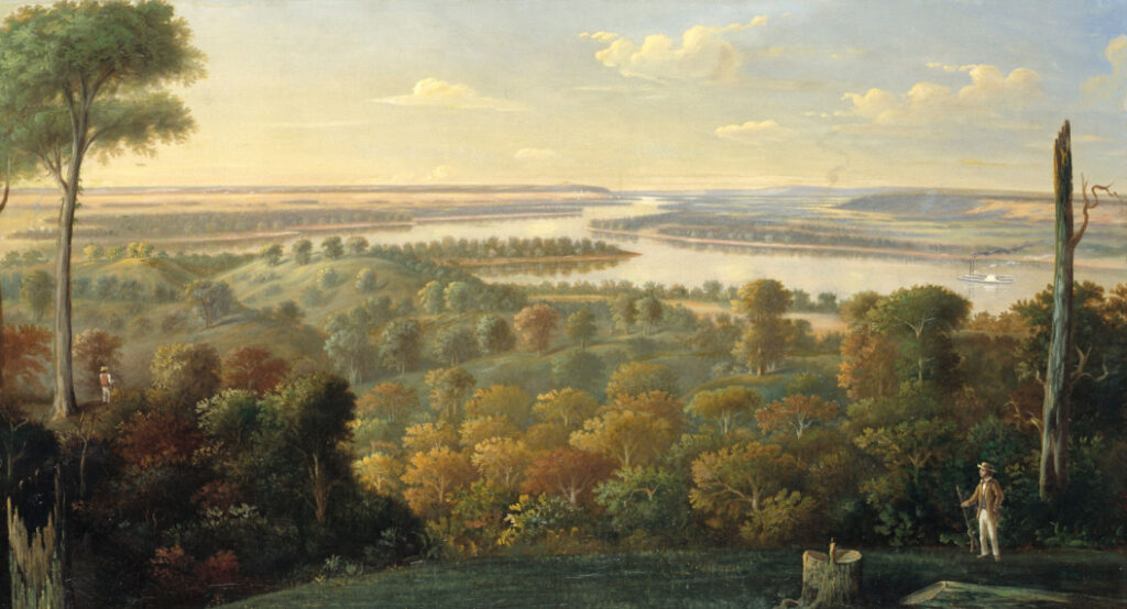
Washington’s preference for “bottom lands” was more than the need for fertility; it reflected the tobacco-centric logic of the Chesapeake world he came from. In Virginia, tobacco dictated geography, planters built their estates along rivers because hogsheads of leaf had to reach ships bound for London. Roads were few, but rivers connected everything. Land without water access was land without profit. Washington carried that mindset west. In the Ohio Valley, where he no longer farmed tobacco, the same logic held: fertile floodplains offered both abundant soil and access to transport. A tract that could feed itself and float its surplus to market was doubly valuable. For a Virginian, river access was not a luxury; it was the measure of a land’s worth.
The “Maryland Monster” and the Mason-Dixon Line
It was here, amid the confusion of contested borderlands, that Maryland’s “Rattlesnake Colonel,” Thomas Cresap and his kin, first learned how borders could shift faster than loyalties. Thomas Cresap, father of Michael Cresap, rose to prominence during seven years of violent border skirmishes between Maryland and Pennsylvania known as the Conojocular War, or simply Cresap’s War.
In Pennsylvania, Cresap was later remembered as “the Maryland Monster.” Well, that’s one of those cases where a later historian probably decided, “they must have said that.” I chased a few trails to find the origin of this nickname, but every one of them ended in twentieth-century sources. Samuel G. Drake, in his 1832 Biography and History of the Indians of North America, used the word monster liberally—nearly a dozen times—but never the phrase “Maryland Monster,” and never in reference to Cresap. He did, however, basically describe Cresap’s son, Michael, as a man bent on murder.[3] For readers following this series from the beginning, I covered both the vilification and the later rare rehabilitation of Michael Cresap’s reputation in Blog 1 – Savage Spring: 1774 and the Mob Violence in the Upper Ohio River Valley. The “Maryland Monster” label for Thomas Cresap, it seems, is a much later invention.
The Pennsylvania Archives presents some of the most colorful accounts of colonial interactions with Thomas Cresap. At one point, while Pennsylvania authorities were arresting him for murder, and setting his house on fire in the process, he shouted that the sheriff’s party were “Damn’d Scotch Irish sons of bitches,” and the people of Pennsylvania, “Damn’d Quakeing Dogs & Rogues.” Cresap believed the land he lived on was in Maryland, while Pennsylvania disagreed. He had been driving Pennsylvanians off what he considered Maryland soil. During this same period, Cresap entered into violent contests with Native groups after, per Maryland’s Governor Ogle, Pennsylvania agents paid those Natives to drive the Cresaps off the Susquehanna’s western bank.[4]
Cresap was held in Philadelphia as a political prisoner for several months, his arrest symbolizing the broader struggle between Pennsylvania and Maryland for control of the lower Susquehanna. His imprisonment inflamed tensions on both sides of the border until London finally intervened, ordering both colonies to cease hostilities and submit their claims to royal arbitration. The so called Conojocular War ended soon after, with Cresap’s release marking its informal close.
Decades later, the Crown dispatched British surveyors Charles Mason and Jeremiah Dixon to establish a permanent boundary and resolve the intercolonial border disputes once and for all. The result, the now famous Mason–Dixon Line, was a boundary born out of chaos and blood.
Preemptive Rights
After the French were expelled from the region, settlers rushed in and began occupying western lands illegally. Pennsylvania, trying to reassert some semblance of order, offered a temporary amnesty: anyone who settled “its” western lands within the next three years would not be evicted but would be allowed to secure legal title by paying the survey fees once officials reached the area. It was a stopgap measure, not a true policy. (The quotation marks around “its” are intentional: Virginia insisted the same ground belonged to them. Spoiler—Pittsburgh is, and remains, in Pennsylvania.) These measures applied to the same western lands Pennsylvania had claimed long before Fort Stanwix — claims that had gone largely unenforced during the war and were now being reasserted in the scramble that followed.
But the land rush moved faster than any colonial government could manage. With land offices hundreds of miles away and settlers staking claims faster than surveyors could ride, Pennsylvania finally had to formalize the reality on the ground. It adopted preemption rights, a structured system that gave the first person to occupy and improve a tract the first right to purchase it legally, so long as they paid the surveying costs. In time, even Virginia had to accept the same frontier logic: possession first, paperwork later. [5]
A Treaty Without Consent
In 1768, the British government quietly admitted what everyone on the frontier already knew: they couldn’t enforce the Royal Proclamation of 1763. At the Treaty of Fort Stanwix, the Haudenosaunee agreed to push the boundary line westward, effectively making the Ohio River the new frontier. But what about the other Native nations that actually lived in and claimed the region? Neither the Haudenosaunee nor the British bothered to consult them. The British recognized the Haudenosaunee Confederacy (known to them as the Iroquois Confederacy) as the dominant Indigenous power in the Northeast—partly because it was easier to negotiate with a centralized authority, and partly because it aligned with their own diplomatic customs and traditions.
The Haudenosaunee asserted sovereignty over the Ohio Valley as territory they had “conquered” in earlier wars, even though by the 1760s they no longer lived there in large numbers. Most Native communities in the region were Shawnee, Lenape, and other displaced peoples, along with groups of Haudenosaunee migrants who had left the confederacy whom colonials labeled collectively as “Mingo.”. This claim had its roots in the Beaver Wars of the mid-seventeenth century, when the Haudenosaunee launched aggressive military campaigns that displaced or subjugated other tribes, including the Shawnee, Susquehannock, and Lenape, particularly in the Ohio Valley. After their victories, the Haudenosaunee asserted sovereignty over those lands, even as displaced nations or newly arriving groups later reoccupied many of them.
Underlying this breakdown was a fundamental cultural disconnect: Anglo-American society assumed all power structures were hierarchical and centralized, failing to recognize that many Indigenous nations operated through local autonomy, kinship based leadership, and consensus. For the Shawnee, Lenape, and others who actually inhabited the region, the Treaty of Fort Stanwix was a betrayal. Their lands were ceded without consultation, signed away by a distant and unaffiliated confederacy.
Conclusion
I realize I’ve paused here to unravel the eccentricities of land claims—but there’s a reason. Before wars break out, before Washington becomes Washington, and before settlers and Native nations collide in the Ohio Valley, the story begins with paper: charters, patents, surveys, preemption rights, and competing worlds of ownership. Once you grasp that the frontier we think we know was shaped by countless micro-moves—missteps, betrayals, schemes, and opportunistic grabs—the next chapters fall into place. The violence that will eventually close this series wasn’t random. It grew from this foundation.
Epilogue
What comes next is not an ending but a widening of the frame. Cresap’s Ferry stood just twenty miles downstream from where Three Mile Island would rise two centuries later. The plant was decommissioned in 2019, but it will be monitored for decades to come. From contested borderland to industrial corridor to nuclear landscape, the same stretch of river has emitted an undeniable energy across time.
The question is not whether the past fades—it’s whether it ever does.
The river still follows the channels settlers cut. Townships and counties map the same boundaries once fought over with muskets and quills. Roads and rails trace the ridgelines of older Native trails. We accept that radiation lingers long after the source has cooled, yet rarely ask what else radiates—quietly, invisibly—from the past.
The point of this series has been to provide backstory, yes—but also to show that we still live inside the afterglow of forces long set in motion.
In the next stage of this story, that lingering energy will ignite. Forts will rise where diplomacy once flourished, and violence will wash over what were once borderlands of negotiation. The invisible tensions of empire will finally combust, burning through the fragile order that once held the backcountry together.
Notes & Citations
[1] United States, John Dunlap, Peter Force, David Ridgely, and Printed Ephemera Collection. In Congress, July 4, a declaration by the representatives of the United States of America, in General Congress assembled. [Philadelphia: Printed by John Dunlap, 1776] Pdf. https://www.loc.gov/item/2003576546/.
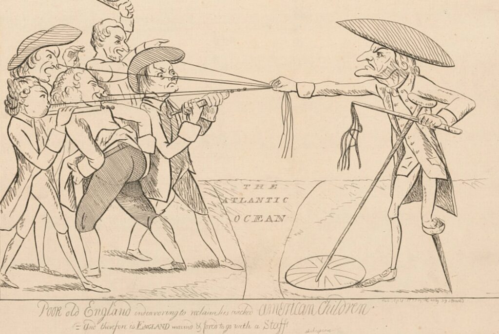
[2] Darly, Matthew, Active , Publisher. Poor old England endeavoring to reclaim his wicked American children
. United States England, 1777. [London: Pub. by M. Darly 39 Strand, Apr] Photograph. https://www.loc.gov/item/2004673329/.
[3] Samuel G. Drake, Biography and History of the Indians of North America (Boston: Benjamin B. Mussey, 1832), 545, https://babel.hathitrust.org/cgi/pt?id=nyp.33433081681565&seq=545
[4] Pennsylvania Archives, 1st ser., vol. 1 (Philadelphia: Joseph Severns & Co., 1852), 320–321, 504–505.
[5] Amelia Clewley Ford, Colonial Precedents of Our National Land System as It Existed in 1800, 102 & 128.
For readers who wish to follow ongoing research, subscription is available in the footer.