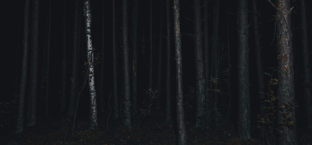
To understand the fear that swept the Ohio frontier, we must first see it through settlers’ eyes—through the visible traces of older worlds that surrounded them.
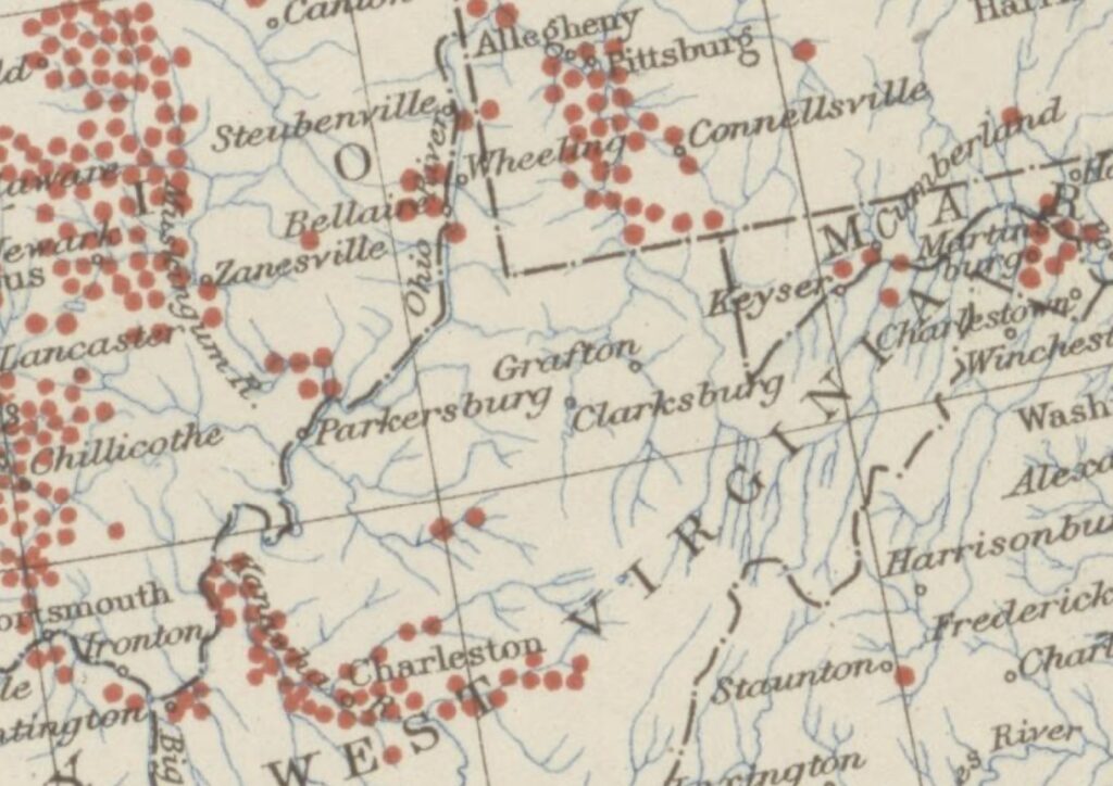
Earthen mounds were once everywhere in the eastern United States, from the Ohio and Mississippi Valleys to the Piedmont, Great Lakes, and Gulf Coast. Built over centuries by Indigenous cultures, these mounds formed one of the most widespread and enduring architectural traditions on the continent, sacred spaces layered into the land itself.
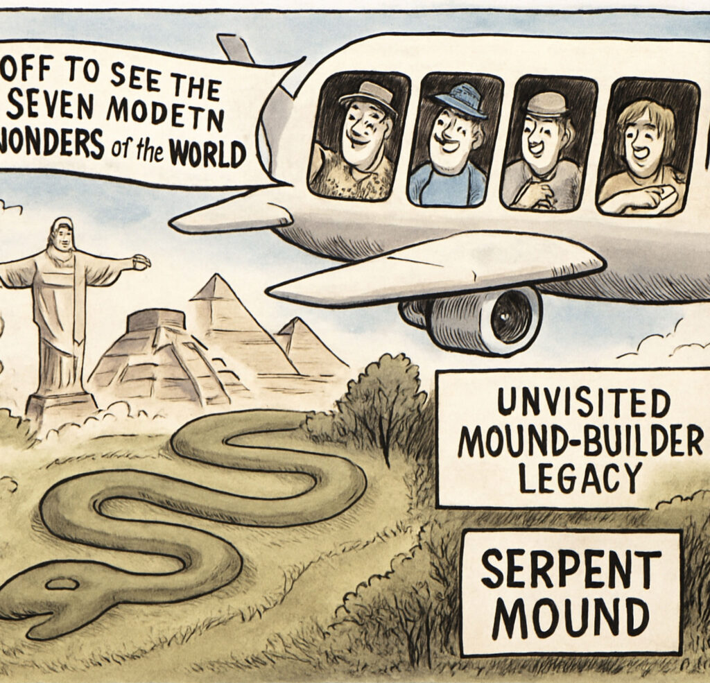
Monks Mound at Cahokia, located in present-day Illinois, is the largest prehistoric earthwork in the Americas north of Mexico. Covering fourteen acres at its base and rising more than one hundred feet high. It is still frequently marketed today as one of “America’s pyramids (Why am I starting with a site in Missouri, well outside the geographic scope of this narrative? Bear with me.)
Applying the term pyramid to earthen mounds may elevate public interest, but the nomenclature misleads. It implies architectural and cultural equivalence with Egyptian or Mesoamerican civilizations, when Cahokia instead represents a distinct expression of ancient eastern North American cosmology, governance, and labor. The more monumental the site is made to seem, the more it becomes detached from its Indigenous roots.
Who were these Mound Builders?
• Adena Culture – c. 800 BCE – 100 CE
Centered in the Ohio River Valley, the Adena built conical burial mounds and earthworks, often on high river terraces.
• Hopewell Tradition – c. 100 BCE – 500 CE
Spread from the Ohio River Valley into the Illinois and Mississippi Valleys, the Hopewell expanded mound-building into elaborate geometric earthworks, linked by long-distance trade networks.
• Mississippian Culture – c. 800 – 1600 CE
Dominated the Mississippi and Ohio River basins, constructing large platform mounds for temples, council houses, and elite residences, with major centers like Cahokia in present-day Illinois.
In the 19th century, the term “Mound Builder” was twisted into a myth of a vanished white race — a fiction meant to erase the legacy of ancient Native peoples. When you know which culture you are referencing, you should use that culture’s name rather than the generic term. Unfortunately, by the time Europeans entered the interior in the 17th century, most mound centers had been abandoned. In the Upper Ohio River Valley, both Adena and Hopewell cultures had left their mark, making it difficult to attribute destroyed mounds to a specific tradition without extant remains to excavate.
The Silence of the Archives
Squier and Davis’s Ancient Monuments of the Mississippi Valley (1848), published as Volume I of the Smithsonian Contributions to Knowledge, was the Smithsonian Institution’s first formal scholarly publication, and it played a foundational role in shaping the field of American archaeology. The work was a sweeping survey of ancient earthworks, an ambitious effort to catalogue the mounds that once dotted the American frontier. Today, the Smithsonian barely mentions them. These structures, once deemed worthy of national attention, have slipped into institutional silence.
Part of that retreat likely stems from shame. The early Smithsonian gave voice to racist theories: that Native peoples did not build these mounds, but by some vanished white race. It was a convenient myth. The dead were noble, advanced, and extinct. The living Native nations, it was claimed, were merely the last wave of conquerors: not the builders, but the destroyers of the “white” civilization that came before. This narrative absolved the American colonization project. It made genocide feel like an inheritance. If the land had already been stolen once, what harm was there in stealing it again?
Today, the Smithsonian is a respected institution committed to advancing science, history, and cultural understanding. Still, its earliest work remains a reflection of the nation’s conflicted relationship with its Indigenous past.
Additionally, the Smithsonian-led mound explorations of the late 19th century were extensive, invasive, and, by today’s standards, deeply unethical, amounting to little more than sanctioned grave robbing. No Native nations need to be consulted because, as far as was understood at the time, no Native nations reported knowing who the builders were. [2]
In the “excavated” mounds, human remains, ceremonial objects, and sacred burial goods were unearthed, catalogued, and shipped to Washington, DC; boxed up and stored, never to be returned. The very act of publicizing the mounds as cultural wonders would mean reckoning with what had been taken. To advertise them now is to admit the scale of the loss.
The majority of artifacts recovered from mound sites during the nineteenth and early twentieth centuries now sit in museum basements and archival storage, not on public display. The true scale of these collections remains largely invisible to the public, fragmented across institutions and shaped by decades of inconsistent documentation.
When federal repatriation laws such as NAGPRA forced museums and agencies to inventory their holdings, it became clear how much had been removed—and how little had ever been accounted for. Public acknowledgment of these collections has often lagged behind ethical reckoning, not through a single act of concealment, but through institutional inertia, fragmented record-keeping, and a long reluctance to confront the full consequences of earlier archaeological practices.
Why stir the pot by calling attention to a cultural legacy that’s already been bulldozed, mined, and erased? So instead, the mounds stay silent, their contents boxed and shelved, waiting for a future in which technology may offer the answers that oral history has been unable to provide.
But what about the “white” civilization origin theory? When archaeology and Native voices confirmed that Adena, Hopewell, and Mississippian peoples had built these monuments, the myth lost its colonial utility, and interest in the mounds dissolved. Today, most Americans have never heard of them. By the late 19th century, most were gone. Farmers leveled them. Railroads mined them for fill. One by one, they disappeared.
Heritage Erased
In 1970, Mormon evangelists who had journeyed to Armstrong Mountain (modern Mount Carbon) in West Virginia, hoping to view an ancient stone wall once said to stretch for miles, found the site utterly erased.[3] The visitors held a fringe belief that the wall marked the remains of an advanced civilization known as the Nephites, who, according to specific interpretations of Mormon doctrine, were visited by Jesus Christ. A local strip mining company was accused of the destruction, though it denied any knowledge of what a subcontractor may or may not have done. In the end, it was an all-too-familiar story: loss disguised as progress. A landscape scraped clean.
It is an unfortunate truth that the road to modern America, carved by highways, bridges, and interstates, came at the cost of a great national culling of Indigenous landscapes. Thousands of Native mounds, once scattered across hillsides, river valleys, and open fields, were bulldozed, mined, or buried beneath asphalt. Progress demanded fill, and the sacred became raw material. The quiet graves of ancestors became on-ramps and cloverleafs. Few paused to notice at the time, and fewer still were willing to intervene.
Most modern Americans don’t realize that the highway beneath their tires may run across the leveled footprint of a burial mound, or that the gravel beneath their bridges once came from one. The past was repurposed without ceremony and lost in the name of forward motion.
Shells Beneath the Plow, Shadows in the Trees
Mounds were not the only reminders of past land use. Freshwater mussels once lined the banks of the Kanawha and other Appalachian rivers. For centuries, Indigenous villages harvested them in large quantities—eating the meat, using the shells as tools, ornaments, or tempering for pottery. The refuse—piles of discarded shells, called middens—built up slowly, layer by layer.
Even today, many former village sites can still be identified by the mussel shells scattered across the ground. These aren’t just archaeological clues hidden beneath soil; they’re still visible on the surface in some places, bleached white by time, a quiet reminder of who lived there before.
Settlers in the 18th century would have walked right over the shells crunching underfoot as they cleared land or planted crops. They may not have understood their meaning, but they knew these places had been lived in long before they arrived. These weren’t untouched wildernesses. They were landscapes shaped by generations of Indigenous presence.
Why Does All This Matter to a 18th Century Historical Narrative?
When surveyors like William Crawford and William Preston paced these landscapes, they rarely treated the mounds as sacred. To them, they were landmarks, boundaries, or, in the case of George Washington’s speculative ventures, useful reference points for dividing tracts. What Indigenous communities understood as holy sites became, in colonial records, little more than bearings in a surveyor’s notebook. That act of translation was itself an erasure, flattening centuries of presence into lines and measurements. Yet the sites were there, and settlers could neither ignore them nor the uncomfortable truth they represented.
These were not obscure piles of earth hidden in remote forests, as they are often imagined today. They were everywhere; visible, massive, unavoidable. To settlers, they were not merely remnants of a distant past but ominous markers of the unknown: reminders that this land had belonged to someone else, and that it might still. In the tense weeks after Yellow Creek, such reminders took on a darker weight. The mounds evoked ancient rites, unknown dead, and a nod toward the power of Native peoples who still lived nearby—people settlers feared would soon come seeking vengeance.
If we picture the frontier landscape as a blank canvas, more wooded, less developed, but otherwise familiar, we mislead ourselves. The Ohio River Valley was already marked. It bore signs of deep time, ceremonial space, and human presence layered over centuries. Settlers may not have known who built the mounds, but they knew someone had. The mounds stood as proof that this was not unclaimed wilderness.
A sixty-foot-long, egg-shaped rise towering thirty feet would not have escaped notice. Large mounds were often built along riverbanks; it would have been impossible to paddle down rivers like the Kanawha without seeing them. Even when a mound lay on someone else’s land, it was not hidden. Early frontier communities still practiced common rights: crossing property freely, gathering food, grazing animals—customs that endured into the mid-nineteenth century before fencing and formal property law erased them.
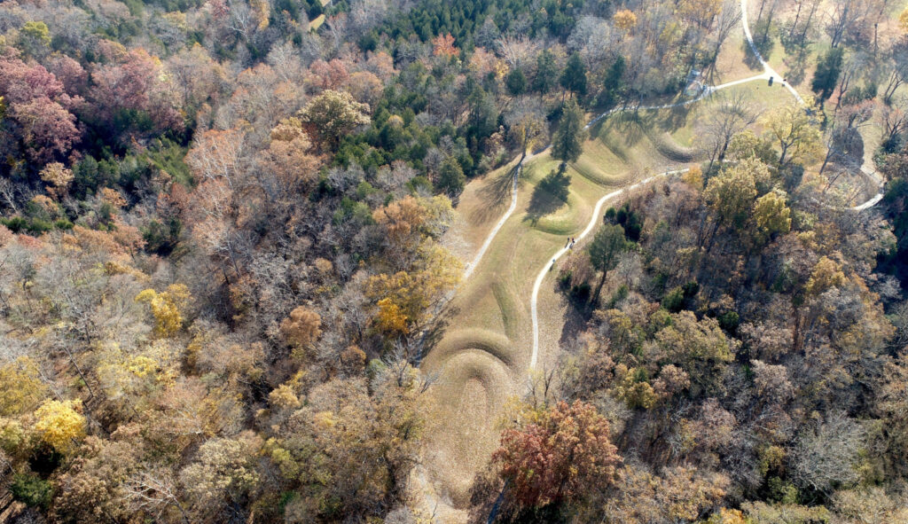
These ancient sites were extensive. Some Hopewell complexes feature paired or symmetrical mounds, not as isolated monuments but as components of larger ceremonial landscapes. Modern surveys have at times struggled to recognize the full scope of such sites precisely because of their scale.[4] Eighteenth-century residents lived amid these layered landscapes without any framework for understanding them, surrounded by evidence of a past that refused to stay buried.
Written in Stone
Another unmissable factor would have been the stone etchings. One such boulder, found on the Miller farm in three miles above the Kanawha’s mouth, was still marked with petroglyphs in 1894. Etched figures on the twenty-foot-wide mass of rock included a double-headed bird, serpents, and a horse leading a trail of tracks pointing downstream. At the time, local observers noted that these images had been clearer fifteen years prior.
Upriver of Yellow Creek, Reverend Henry C. McCook reported: “…the rocky surface is covered with signs and figures of various sorts… images of braves with their scalp locks… fishes and birds, turtles… beavers and squirrels, and the tracks of animals.”He also noted carved human footprints, “apparently of natural size and shape,” cut deep into the limestone, as if traced around a living foot. [5] The petroglyphs McCook reference here are now beneath the waters of the New Cumberland Locks and Dam.
Most of these carvings predate European contact by centuries, if not millennia, with stylistic continuity indicating long-term cultural reuse rather than a single, isolated “mound-builder” episode. At Safe Harbor Dam along the lower Susquehanna River, more than three hundred petroglyphs survive, forming the largest known concentration in the northeastern United States.
Conclusion
Before we can trace the fear, violence, and dislocation that swept across the Pennsylvania and Virginia frontier in the summer of 1774, we must first confront the land settlers saw; not as we imagine it now, but as it truly was. In the wake of the massacre, every sign of the past became a threat. With every crunch of shells beneath their boots, settlers were reminded that this was not untouched wilderness, but a world already marked, already lived in, already sacred to someone else.
Each mound on the horizon became a warning; each etched stone, a silent threat. After Yellow Creek, these features stopped being curiosities. They became proof—proof that people had lived here, buried here, claimed here, and could return to punish.
Appalachia’s geography—its ridges, its hollows, its tangled river forks—the complexity of life there is often flattened into myth. But the terrain shaped settlement. It shaped fear. It shaped resistance. The story of 1774 can’t be told without understanding that both the land and the people who moved through it were carrying older histories—some visible in the soil, others deliberately erased from it.
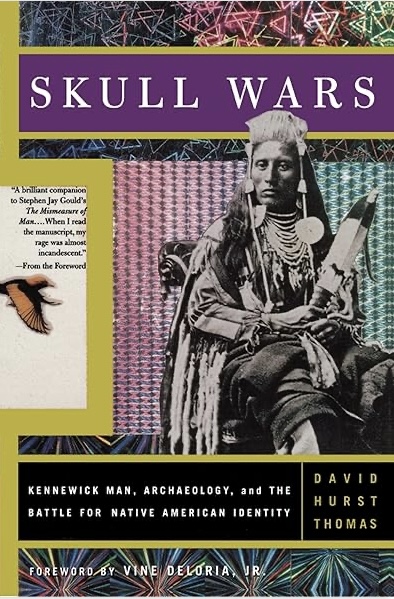
For additional reading: see, Skull Wars: Kennewick Man, Archaeology, and the Battle for Native American Identity, by Jeffrey Hantman, or any of the peer-reviewed articles by Dr. Bradley Lepper for more information.
Notes & Citations
[1] Smithsonian Institution. Bureau Of American Ethnology., Cartographer. Distribution of mounds in the eastern United States. composeds by Thomas, Cyrus, Iler [Washington, D.C.: U.S.G.S., 1894] Map. https://www.loc.gov/item/2023593003/.
[2] Bradley T. Lepper, “Native American Oral Traditions and the Archaeology of Eastern North America,” Journal of Ohio Archaeology 3 (2014): 1–18, https://www.ohioarchaeology.org/journal/index.php/joomla/index.php?option=com_content&task=section&id=10&Itemid=54.
[3] “Mystery Walls on Armstrong Mountain.” West Virginia Department of Arts, Culture and History, March 5, 1970. https://archive.wvculture.org/history/nativeamericans/mysterywalls02.html. Cyrus Thomas, Report on the Mound Explorations of the Bureau of Ethnology (Washington: Government Printing Office, 1894), University of California Libraries, https://archive.org/details/reportonmoundexp00thomrich. Pg. 409
[4] Thomas F. King, Cultural Resource Laws and Practice, 4th ed. (London: Bloomsbury Academic, 2013), 118.
[5] Thomas, Report on the Mound Explorations of the Bureau of Ethnology. 437. Henry C. McCook, The Latimers: A Tale of the Western Border (Philadelphia: Presbyterian Board of Publication, 1856), 24–25, accessed via Internet Archive, https://archive.org/details/thelatimers00mccorich/page/n31/mode/2up
For readers who wish to follow ongoing research, subscription is available in the footer.